Why the Ghana-Togo Maritime Boundary Delimitation Must Go for International Arbitration
By: Vice Admiral Issah Adam Yakubu
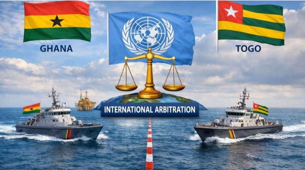
On 20 February 2026, the Government of Ghana formally notified the Government of Togo of its decision to resolve their maritime boundary impasse through international arbitration under the United Nations Convention on the Law of the Sea (UNCLOS). The Ghanaian authorities cited that eight years of bilateral negotiations had failed to produce an agreement, and expressed a desire to prevent further incidents that were straining relations between the two countries’ institutions. This move by Ghana is timely and arguably necessary. Attempts to delimit the boundary date back several decades, but efforts intensified over the last eight years amid hopes of a quick resolution. Numerous meetings of a Joint Boundary Delimitation Committee, follow-up ministerial engagements, and even a presidential summit were held – yet none yielded a final deal, with tentative technical agreements often being overturned at higher political levels. Given this protracted deadlock, recourse to international arbitration offers a path to a conclusive and peaceful settlement of the dispute.
History of the Dispute
The maritime boundary dispute between Ghana and Togo has deep historical roots, even though it only flared into open conflict in recent years. Like many African boundary issues, the origin lies in colonial-era arrangements – the land border between what became Ghana and Togo was demarcated by British and French authorities, but no clear offshore boundary was ever defined. After independence (Ghana in 1957 and Togo in 1960), the lack of a defined maritime border lingered in the background for decades. The issue became more pressing as offshore economic interests (fisheries and, later, hydrocarbons) grew in importance. By some accounts, the dispute has “lasted for half a century” without resolution, even though formal negotiations only began in 2018. In practical terms, both countries long avoided confrontation at sea, and the absence of incidents kept the dispute low-profile for years.
The status quo of benign neglect changed in late 2017. Fresh off a legal victory in a maritime boundary case against Côte d’Ivoire in September 2017, Ghana expanded its offshore exploration activities toward its eastern waters – an area that borders Togo. Tensions spiked when Togolese authorities intervened between December 2017 and May 2018 to stop two Ghanaian seismic survey vessels from operating in waters that Ghana considered its own. Togo asserted that those waters fell within its claimed maritime zone, effectively bringing the dormant dispute into the open. This flashpoint – occurring just months after the Ghana–Côte d’Ivoire boundary was settled – rang alarm bells about a potential Ghana–Togo conflict.
In response, both nations moved to the negotiating table in 2018 to prevent escalation. A Joint Ghana–Togo Boundary Commission and technical committees were established to work out an agreed delimitation. Multiple rounds of talks were convened: by early 2023, at least six negotiation meetings had been held, with the goal of drafting a boundary agreement and roadmap for approval by the two governments. Progress was made on some technical fundamentals – for instance, by 2021, Ghana and Togo had agreed on the precise coordinates of the land boundary terminus (the coastal border point) and on the baseline charts to be used as the starting point for the maritime boundary. These steps laid important groundwork. However, when it came to drawing the actual boundary line across the sea, substantive differences prevented a deal. On paper, negotiation teams sometimes reached tentative compromises, but these were often reversed by higher authorities amid political concerns. A high-level push in mid-2021 by President Nana Akufo-Addo of Ghana and President Faure Gnassingbé of Togo, aimed at clinching an agreement within a four-month deadline, ultimately did not bear fruit. By late 2025, with talks effectively stalled and both sides unwilling to concede further, Ghana concluded that the only viable way forward was to submit the matter to binding international arbitration.
The Position of International Law
International law provides a well-established framework for resolving maritime boundary disputes such as this. Under UNCLOS, neighbouring coastal states with overlapping claims are obliged to negotiate in good faith to reach an agreement that achieves an “equitable solution.” If bilateral efforts fail, UNCLOS compulsory dispute settlement mechanisms (such as arbitration or adjudication) can be invoked to determine the boundary. Ghana’s decision to resort to arbitration is in line with UNCLOS procedures and reflects a broader trend in maritime disputes towards legal resolution rather than indefinite negotiation. By pursuing arbitration, Ghana seeks a binding determination that will definitively fix the boundary – a result that political negotiations have been unable to deliver. Togo, as a party to UNCLOS, would be bound by the arbitral tribunal’s award, just as Ghana will be, ensuring a clear outcome that both must respect.
Over the past few decades, international tribunals (including the International Court of Justice and the International Tribunal for the Law of the Sea) have developed a consistent methodology for delimiting maritime boundaries. They typically employ a three-stage approach: First, draw a provisional equidistance or median line between the coasts of the two states. Second, consider whether there are any relevant circumstances or inequities that warrant adjusting that line. Third, perform a proportionality check to ensure the result is not grossly disproportionate relative to the lengths of the parties’ coastlines. This approach aims to balance geometric objectivity with equitable considerations. In many cases, the end result closely mirrors the initial median line – as seen in the 2017 Ghana/Côte d’Ivoire arbitration, where the tribunal ultimately adopted a “strict, un-adjusted equidistance line,” finding it achieved an equitable solution. The Ghana–Togo situation will be evaluated on its own merits, but past jurisprudence suggests that international law tends to favour clear, principled boundaries unless compelling reasons justify a deviation. By taking the dispute to an international tribunal, Ghana (and Togo) are effectively entrusting this well-honed legal framework to produce a fair outcome that both sides might not be able to agree upon politically
Peculiar Circumstances
No two maritime disputes are identical, and the Ghana–Togo case has some unique geographic and historical features that deserve note. A key factor is the stark difference in the two countries’ coastal lengths and orientations. Togo’s coastline is only about 56 km long – a short sliver fronting the sea – whereas Ghana’s coastline stretches roughly 539 km along the Gulf of Guinea. Togo’s coast lies between the much larger coastlines of Ghana to its west and Benin (and indirectly Nigeria) to its east, placing Togo in a concave geographic corner of the Gulf. This configuration means that a strict equidistance line drawn from Togo’s tiny coastal frontage could quickly converge with lines from Ghana and from Benin, potentially “cutting off” Togo’s access to broader maritime zones. International courts have long recognised that concave coasts can lead to inequitable outcomes if a median line is applied rigidly – the classic “coastal concavity” problem where the state in the recess gets a disproportionately small maritime area. Togo has implicitly raised this concern in its negotiations, arguing that special circumstances entitle it to a more expansive maritime slice than the basic geometry might grant.
Another circumstance is the economic stakes involved. The disputed area lies in the petroleum-rich Gulf of Guinea, and both nations have offshore oil and gas interests at play. Ghana has already developed major oilfields farther west (near Côte d’Ivoire), and interest in exploring the eastern offshore blocks near Togo grew after the Ivorian boundary was settled. Togo, for its part, does not yet have significant oil development, so access to any prospective resources in the shared boundary area is particularly important to it. This dynamic can heighten tensions: Ghana’s head start in exploration, and its more advanced oil sector, mean it has greater capacity to utilise the area, while Togo may feel at risk of being left out if the boundary is drawn too far eastward. Additionally, the location of the land border terminus (boundary pillar on the coast) is near a populated area (Ghana’s Aflao and Togo’s Lomé) and close to the mouth of a lagoon and the Volta River delta. This area’s geography (low-lying sands, shifting river sediments) required careful technical work to agree on a starting point for the maritime line. Indeed, negotiators agreed on the exact coordinates of the coastal starting point (boundary pillar “Pillar 1”) and the baseline from which the line would extend, indicating that both sides addressed these technical peculiarities cooperatively. Yet, despite resolving these details, the big picture remained: how to draw a line seaward that reflects both Togo’s constrained coastline and Ghana’s extensive one. These peculiar circumstances – a classic disparity in coastal lengths and a concave gulf setting – form the backdrop to the positions each side ultimately adopted.
Positions Adopted by Both Countries
Throughout the negotiation process, Ghana and Togo consistently advanced divergent positions on how the maritime boundary should be delimited. Ghana’s position has been anchored in the application of standard equidistance principles under UNCLOS and established case law. Essentially, Accra has favoured drawing a median line outward from the point where the countries’ land border meets the sea – a line roughly perpendicular to the general direction of the coast, giving each state a maritime zone proportional to its coastline. Ghana’s approach was influenced by its confidence in legal precedent (notably the Ghana–Côte d’Ivoire ruling) and by the fact that Ghana had already partitioned and exploited offshore blocks up to what it considered a reasonable boundary. Indeed, Ghana had been treating part of the contested area as its own – licensing exploration there and even beginning seismic surveys – based on what it viewed as a logical delimitation line. In June 2021, Ghana formally submitted a provisional demarcation line to Togo during negotiations, reflecting this equidistance-based approach.
Togo’s position, on the other hand, has been more assertive in demanding an adjustment that accounts for its limited coastal frontage. Togolese negotiators have essentially argued that a straight median line would unfairly curtail Togo’s maritime entitlements, and they have sought a boundary drawn further west of Ghana’s proposal. In practice, Lomé appeared to advocate either a different methodology (for example, an angle bisector or other equitable angle that gives Togo more sea room) or at least a shifted equidistance line that expands Togo’s share of the offshore area. Togo backed its stance by pointing to its special circumstances – principally the short length of its coast and the need to secure a viable economic zone – as justification for a boundary that is not simply the geometric halfway line. In reaction to Ghana’s 2021 proposal, Togo’s authorities immediately took a hard line: they rejected Ghana’s provisional line outright, fearing that accepting any “interim” line close to Ghana’s preference would later become permanent to Togo’s detriment. Instead, in July 2021, Togo presented a counter-proposal for the boundary, signalling its insistence on a more favourable division of the contested waters. While details of Togo’s proposal were not made public, it clearly allocated a larger portion of the maritime space to Togo than Ghana was willing to cede, reflecting Lomé’s resolve to protect what it views as its rightful maritime entitlement.
Technically, the two sides also disagreed over the precise methods and data to use in delimitation. During talks, differences arose over the choice of baseline coordinates and nautical charts to plot the line, as well as the legal method (strict equidistance versus adjusted line). Each side naturally selected the technical interpretation that bolstered its claim. For example, there might have been disputes on which coastal points to use as basepoints for an equidistance line, since slight variations can shift the line’s trajectory. These technical position gaps proved difficult to bridge because they were tied to each country’s larger strategic aim: Ghana’s to maintain a boundary close to the status quo line where it had been operating, and Togo’s to substantially alter the status quo in its favour. Despite multiple negotiation sessions and expert committee work, Ghana and Togo remained unable to reconcile these positions, setting the stage for the current recourse to an impartial arbitral tribunal.
Options Presented by the Two Countries
During the negotiation phase, the main options on the table effectively boiled down to Ghana’s proposed boundary line versus Togo’s proposed boundary line – with little overlap between the two. At the June 2021 meeting of the Joint Technical Committee, Ghana’s team presented a detailed chart with a provisional boundary line extending seaward from the coastal border point. Although the specifics are confidential, this line was reportedly close to the median line derived from an equidistance calculation. It likely ran in a southeast direction into the Gulf of Guinea, equidistant from Ghana’s and Togo’s nearest coastal points, thereby granting Ghana a significant portion of the offshore area that Togo later contested. Ghana touted this option as consistent with international law and past practice, emphasising its fairness and the clarity it would provide. From Ghana’s perspective, this was a practical solution that could be quickly formalised, allowing both countries to move on to exploiting resources without fear of overlap.
Togo, confronted with Ghana’s proposal, countered by tabling its own alternative boundary option in late July 2021. Togo’s counter-proposal presumably angled the line further southwest (toward Ghana) than Ghana’s version did, thereby enlarging Togo’s maritime zone beyond what a strict midpoint line would yield. Togolese negotiators have not publicly disclosed their exact coordinates either, but the move was described as a “hard-line stance”. Essentially, Togo’s option staked claim to a much greater share of the contested offshore territory – possibly using an approach like an angle bisector of the two countries’ general coastline orientations, or referencing historical sector lines. By making this counter-proposal, Lomé signalled that it was not prepared to accept a compromise too close to Ghana’s position. It treated Ghana’s earlier line as overly generous to Ghana and unacceptable as a basis for even interim arrangements. Each country’s proposal was backed by technical justifications and legal arguments, and throughout 2021 and 2022, the bilateral talks focused on reconciling these starkly different lines.
Various compromise ideas were explored. There were discussions about “practical arrangements” pending a final deal – for instance, how to manage the area jointly or how to avoid disrupting each other’s activities while the boundary was unresolved. At times, mediators floated the idea of a joint development zone as a creative option: rather than drawing a single line, the two states could agree to jointly manage and share resources in an overlapping zone. Such arrangements have been used elsewhere in the world when boundary disputes prove intractable. However, in the Ghana–Togo case, neither side showed enthusiasm for indefinitely sharing the area; both preferred to secure sovereignty over clearly defined territories. Thus, the focus remained on choosing a single delimitation line, with each government essentially advocating for the option most favourable to itself. The gap between Ghana’s and Togo’s positions, unfortunately, was too wide for an amicable middle ground to be found. By the end of 2025, after numerous exchanges and even a draft agreement that never got political approval, the menu of options had narrowed to one: let an independent international tribunal weigh the merits of each side’s claims and decide the boundary impartially.
Effects of Absence of an Agreed Maritime Boundary
The failure to reach an agreed maritime boundary over the years has not been cost-free – it has had tangible negative effects for both Ghana and Togo. For one, the disputed status of the offshore area has effectively paralysed economic activities in that zone. Since 2018, Ghana and Togo have mutually refrained from licensing new oil exploration or allowing fishing fleets to operate in the contested waters, to avoid provoking each other. This moratorium, while prudent for maintaining peace, also means lost opportunities: potential oil and gas discoveries remain untapped, and rich fishing grounds cannot be fully utilised by local communities. Both countries have had to put investment plans on hold and likely missed out on revenue that a resolved boundary would have unlocked. The Ghana Boundary Commission’s reports noted that the dispute led to a halt in all fishing and petroleum exploration activities in the affected area, underscoring the direct economic toll of the stalemate.
Moreover, the absence of a clear boundary has led to recurring maritime incidents and tensions that periodically strain Ghana–Togo relations. The initial seismic vessel standoff in 2017–2018 set a precedent for confrontation. Since then, there have been other near-incidents at sea. For example, in April 2021, a curious situation arose when a commercial tanker en route to Togo’s port in Lomé had to be escorted by the Ghanaian Navy to the edge of the disputed zone. Ghana likely did this to ensure the vessel’s safe passage (and perhaps to assert its jurisdiction), but the action greatly irritated Togo, which saw it as an encroachment. This kind of scenario – where even routine maritime traffic becomes entangled in the dispute – shows how a lack of a defined boundary creates confusion and distrust. Both nations’ naval and enforcement agencies have had to exercise restraint and constant communication to prevent encounters from escalating. Togo at times complained about Ghana’s naval patrols entering what it considers Togolese waters, while Ghana grew concerned about Togolese interference with its licensed activities. Even scientific research or environmental monitoring in the area has been complicated, since any unilateral action is viewed suspiciously by the other side.
Diplomatically, the unresolved boundary has been a persistent source of friction. It has required continuous attention and negotiations, diverting time and resources that could be spent on other bilateral cooperation. Periodic domestic political pressures also flare up – for instance, nationalist sentiments in either country can make compromise on the boundary difficult, as leaders fear being seen as “giving away” territory. In short, until the boundary is settled, uncertainty reigns. This uncertainty hampers long-term planning for coastal development, environmental management, and security cooperation in the Gulf of Guinea. It also opens the door to potential third-party risks – such as poaching by foreign fishing vessels or unauthorised resource exploitation – since ambiguity over jurisdiction can be exploited by outside actors. All these effects underscore why resolving the boundary is so important. The status quo is untenable in the long run: it carries economic costs, risks unintended clashes, and impedes the full potential of Ghana–Togo relations. This is precisely why Ghana’s move to seek arbitration, ending years of indecision, has been welcomed by observers as a responsible step to unlock the situation.
Way Forward
With Ghana now formally submitting the dispute to international arbitration, a clear path forward has finally emerged to settle the Ghana–Togo maritime boundary. The first step will be to constitute an arbitral tribunal under UNCLOS – a panel of impartial experts who will hear the case. Both Ghana and Togo will have the opportunity to appoint arbitrators (usually five in total on an UNCLOS Annex VII tribunal) and to present their detailed evidence, maps, and legal arguments. The proceedings will follow a schedule for written pleadings and oral hearings, after which the tribunal will deliberate and issue a binding award defining the maritime boundary coordinates. This process, while definitive, is not quick; it can take several years before a final award is delivered. During this period, it is crucial that both countries maintain the spirit of cooperation and restraint. UNCLOS obliges states in such situations to avoid jeopardising or hampering the final resolution, meaning no new unilateral drilling or aggressive patrolling in the disputed area. Encouragingly, Ghana and Togo have experience in this regard: even amid negotiations, they agreed to practical interim measures, such as joint patrols, coordinated fishing arrangements, shared scientific research, and unhindered maritime navigation for each other’s vessels. Continuing and strengthening these confidence-building measures will ensure that the arbitration unfolds in a calm atmosphere, without further incidents.
Once the arbitral tribunal renders its decision, Ghana and Togo must accept it in good faith. The expectation is that, having chosen the legal route, both nations will adhere to the ruling just as Ghana and Côte d’Ivoire complied with theirs in 2017. Implementation will involve cartographers plotting the newly delimited line on official charts, and the two governments likely signing a formal boundary agreement to record the coordinates. Both sides should prepare to educate and inform local stakeholders – such as fishermen and naval officers – about the new boundary to prevent any post-delimitation confusion. If the tribunal’s line splits any petroleum deposits or straddles important fishing grounds, Ghana and Togo would benefit from negotiating cooperative arrangements (for example, joint development or revenue-sharing mechanisms) to manage those resources efficiently and peacefully. Such cooperation would turn a potentially divisive situation into a win-win opportunity.
In the broader picture, a successful arbitration and compliance by Ghana and Togo will send a positive message to the region. It will demonstrate a commitment to the rule of law and peaceful conflict resolution, reinforcing stability in West Africa’s maritime domain. For Ghana, resolving this last outstanding maritime boundary (after the Côte d’Ivoire case) will mean it has fully defined, undisputed borders at sea – a boon for investor confidence and regional relations. For Togo, it will finally secure clarity and the chance to attract exploration investment into its offshore (something that was nearly impossible under uncertainty). Both countries will then be free to focus on the sustainable development of their marine resources and on collaboration in other areas of mutual interest (such as marine environmental protection or anti-piracy efforts in the Gulf of Guinea).
Conclusion
International arbitration represents the prudent and effective way forward for the Ghana–Togo maritime boundary delimitation. It removes the dispute from the realm of endless politicking and places it before a neutral adjudicative body guided by principles of law and equity. The move forestalls further escalation and provides a time-bound process that leads to a clear result. While the road to a final award may be lengthy, the end is in sight: a definitive maritime boundary that both Ghana and Togo can accept and move beyond. By choosing the path of law over force or stalemate, the two neighbours are upholding the idea that even the thorniest disputes can be resolved peacefully when nations have the courage to trust an impartial international system. The hope now is that this arbitration will result in a fair outcome, laying the foundation for enduring friendship and cooperation between Ghana and Togo on the blue waters.
About Vice Admiral Issah Adam Yakubu (Rtd)
Vice Admiral Issah Adam Yakubu is the immediate past Chief of the Naval Staff of Ghana. He is a thought leader, maritime strategist and founder and Chair of the Gulf of Guinea Maritime Institute, a think-tank in strategic maritime affairs in the Gulf of Guinea